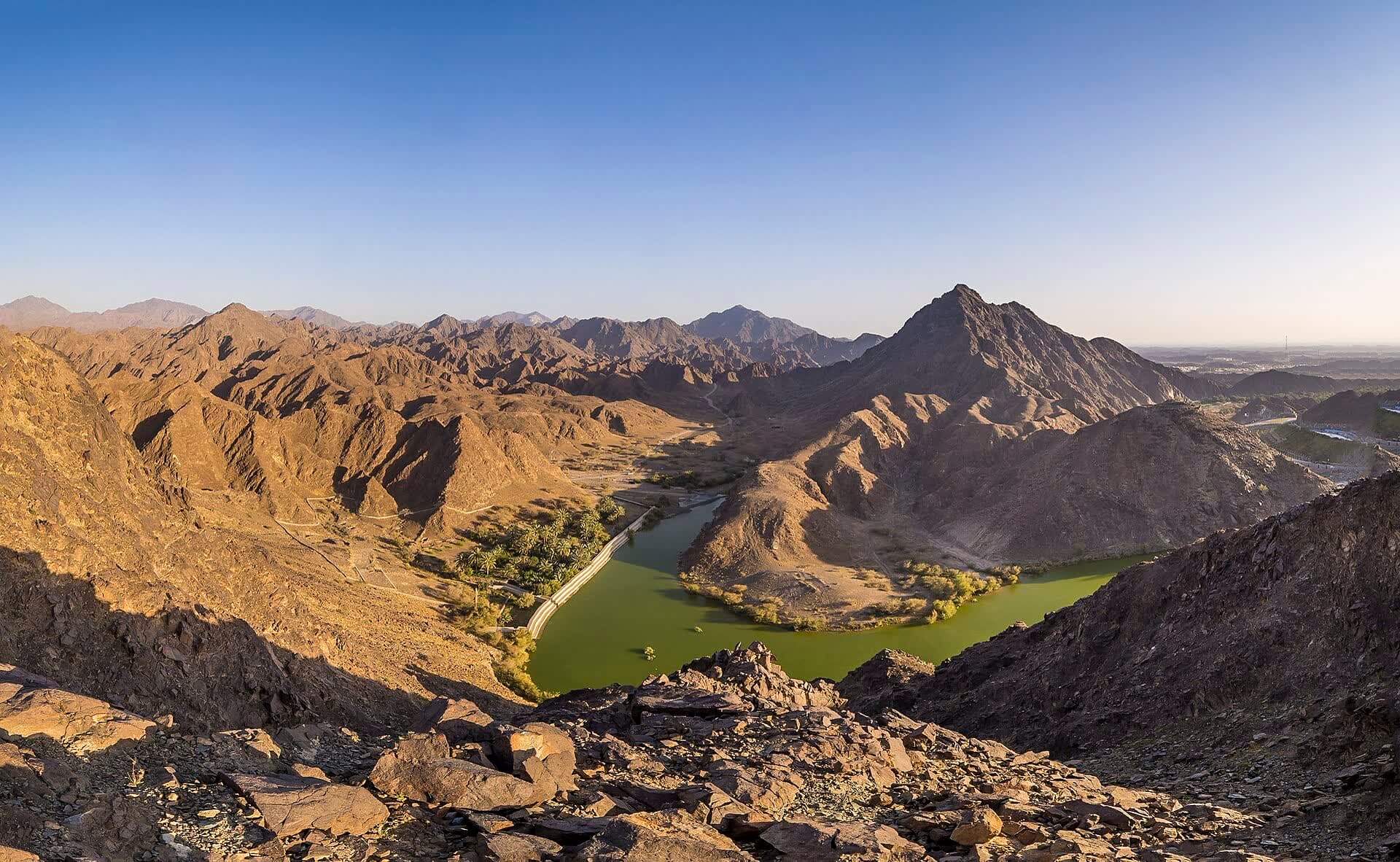
Shawka Dam is in the Wadi Shawka area of Ras Al Khaimah, a mountain landscape associated with outdoor walks and longer hikes. Its appeal is the contrast with the emirate's coastal resorts: rocky slopes and a valley setting take the place of an open sea horizon. Water levels and current access are variable, rather than fixed features of the visit.
A change of scale among the rocky hills.
The dam gives a point of reference within a much wider landscape. A short visitor stop can be about the shape of the valley and the surrounding hills, while a hike is a separate undertaking that needs an identified route. The word wadi is important to understanding the scene: this is a landscape shaped by intermittent water, not a promise of a permanent lake. A dry view can therefore be as characteristic as a photograph showing a full reservoir. For someone interested in landscape photography, the relationships between ridges, rock and open sky may be more dependable subjects than water reflections. The official Ras Al Khaimah destination map identifies Wadi Shawka, supporting its place in the emirate's outdoor geography, but it is not a detailed trail guide or a current access bulletin. The distinction leaves room for an enjoyable modest outing without presenting an unfamiliar walk as an easy, fully documented route.
Planning a visit to Shawka Dam
A half-day can suit a confirmed visitor stop and time in the mountain setting. A longer hike needs its own preparation, current route information and a realistic assessment of the group's ability. This article does not specify a trail distance or difficulty because those depend on the exact route, rather than the destination name. Water, appropriate footwear and protection from the sun are useful even for a shorter outdoor visit. Weather in the surrounding mountains matters as well as the sky overhead: a wadi or flooded road is not a suitable place to continue during runoff. The reservoir should not be treated as a swimming facility. These limits leave the main attraction intact, which is spending time among the hills rather than completing a particular physical challenge. A short visit may suit a mixed-age group better than turning a scenic stop into an unplanned hike.
Location and arrival
The current public approach and final road surface need confirmation for the chosen visitor point. A general mountain pin can lead towards a track intended for a different kind of outing. The tourism map locates Wadi Shawka but does not establish permission for every dam structure, road or trail around it. An arrival on a confirmed suitable route gives the day a clear boundary. Shees Park and Al Rafisah offer other mountain-and-water settings in Sharjah, but they are separate destinations rather than adjacent facilities. Someone looking for a landscaped family park may prefer that style of outing, while Shawka suits interest in the broader mountain landscape. The choice depends on the experience wanted, not just the presence of water in a photograph.
A little more UAE in your inbox.
Weekend places. Neighbourhood notes. A closer look at what is changing.
Questions people ask
Will Shawka Dam be full of water when I visit?
No particular water level is established here. Rainfall and reservoir conditions change the view. The dependable reason to consider the area is its mountain setting, with a visit still dependent on current weather and confirmed public access.
Opening hours, prices and entry rules change. Confirm with the venue before you set off.